|
Street Scenes in Caruthers Corners
“For a long time after we had left this field behind, we followed firefly roads. We made turns, passed dark barns, went by lonely farmhouses where moths fluttered at the lighted window screens. Around us always, wherever we went, streamed the sparks of living fire... They passed us in a constant meteor shower. So we wandered – half-lost and forgetful of time. For hours we followed little roads, roads without a name, roads we could never find again, but roads we will never forget.”
- Edwin Way Teale, Hoosier author and Pulitzer
Prize-winner, The American Seasons
|
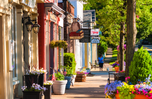
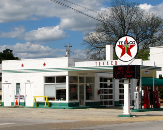
Pick up a road map at Flynn’s Texaco. Or easier, go to the Map page on this website. Doing this will give you an overview of the town, a better understanding of its layout. This can be handy when reading the Quilters Club books, helping you picture the locales in your head. It’s not so hard to find your way around.
• North Main Street – The town’s “main drag” extending past the Town Hall and Town Square.
• South Street – The town’s business district. Two short blocks on the south end of Main Street.
• First Avenue – Longest street within the town limits. Mary Hegler’s old Victorian is found at the far end near Green Scum Pond.
• Second Avenue – Flanks the north side of the Town Square. Site of the old Taylor Mansion.
• Melon Ball Lane (Third Avenue) – Beasley Arms and other affordable housing units line this street. Buckley Jackson bought a small house here.
• Fourth Avenue – The US Post Office is located on corner of Fourth and Main.
• Melon Pickers Row – A tree-lined residential street, site of the Madisons’ magnificent Victorian home, Melanie Heidecker’s beautiful clapboard house, along with several others.
• First Street – A forlorn street behind Town Hall where abandoned warehouses, tire services, and auto parts stores are found. Grumman’s Granary is at the south end.
• Second Street – Site of St. Paul’s United Methodist Church and nearby Madison Elementary.
• Third Street – Location of Pleasant Meadows Baptist Church. The one with the tall spire.
• Fourth Street – More residential housing. The address of Mrs. Fogerty’s Rooming House, Melon Fields Apartments.
• Highway 33 – Connects to Fourth Street via Melon Ball Lane. Leads to Melon Hill. Location of Mike’s Sporting Goods.
• Rocking Chair Lane – A street lined with modest residential houses.
• Melon Seed Road – A street where the Yagers live.
• Jinks Lane – Short street with the Duncan house, Yosterman house. Leads to High Jinks Hill.
• “High Jinks Hill” – This is local kids’ name for the steep street that goes up to the Perricock Mansion. Popular for sledding in the winter. A dead-end.
• Hoople Hill (formerly Lookout Hill) – Site of the Hoople Mansion. A dead-end street.

• Easy Chair Lane – Site of the Johnson house, Andrews house, and the Home for Retired Circus Performers. Leads to the gates of the EZ Seat Chair Factory.
• Melon Rind Circle – Location of Rita Rutaberger’s big green house with its twin chimneys, known as Melon Rind House.
• Watermelon Seed Alley – A narrow passage between Kupnick’s Pharmacy and the State Farm office. Connects Main Street and First Street. A shortcut for pedestrians.
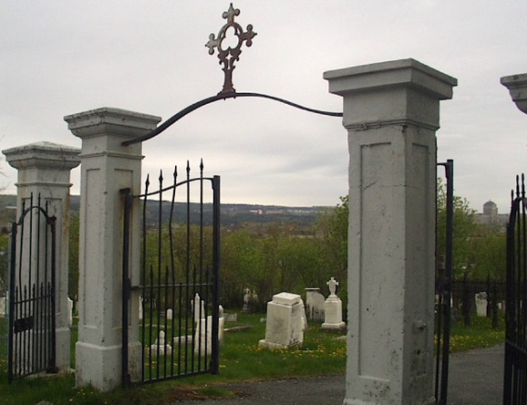
• Pleasant Avenue – A narrow tree-lined road that leads past Pleasant Glade Cemetery. Links to River Road. No houses on the stretch, other than the cemetery caretaker’s cottage.
• Field Hand Road – A shortcut around the town, location of the old Caruthers house. Mostly cornfields.
• Highway 21 North – Location of Flynn’s Texaco. A bypass around Caruthers Corners.
• Highway 21 South – Site of Wabash Acres Retirement Village, home of Emily Polk. A bypass around Caruthers Corners.
|
 |
• Old Farm Road – A straight stretch that ends with a dangerous curve. Site of many automobile wrecks. Deputies are known to park behind a billboard on this road to catch speeders.
• Highway 101 – Concrete bridge crosses the Wabash River. Fishing Hole where Big Calvin lurks. Leads toward Injun Woods.
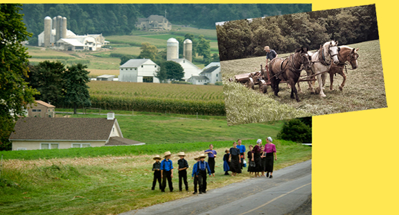
• Highway 102 – A state route near Never Ending Swamp. Leads to Gruesome Gorge State Park. Passes by Abram Wagler’s well-kept Amish farm. You can identify the farm by the lack of electric lines from the poles along 102.
• River Road – A narrow cracked-asphalt roadway that follows the curve of the Wabash River for 37 miles on the western side of Caruthers County. Site of original Jinks house. Current location of the Ridenours’ lavish Tara-like mansion.
• Melon Rind Road – On western side of the Wabash. Location of Bobby Ray Purdue’s ultra-modern new home. A dead-end. Houses Bobby Ray’s eccentric collections.
• Cloven Hoof Lane – On western side of the Wabash. Site of ruins of Mad Matilda’s cottage and a stone well. A dead-end. Surrounded by acres of watermelon fields.
• Far Fields Road – On western side of the Wabash. Dirt road that eventually dead-ends at an old ASOS weather station.
• Cow Pasture Road – Location of Old MacDonald’s Dairy Farm. Surrounded by grassy fields with grazing Guernsey cattle. Owned by the Hitzer family.
• Burpyville Highway – Two-lane blacktop that connects Caruthers Corners and Burpyville. There it merges into Interstate 69 South, the “main road” leading to Indianapolis.
• State Road 73 – A highway near Burpyville that leads to Amish Acres.
• State Road 31 – Leads past the Burpyville Regional Airport.
|
|

